Observed data
Observed data include
field measurements as well as information from satellite images.
Field measurements are often used to calibrate the satellite images: When
you know that the temperature in a certain place was 1°C because you were
there yourself and measured it, you can see what the pixel for the time and
place you were in looks like on a satellite image of temperature. Even
so, satellite measurements are considered to be somewhat uncertain.
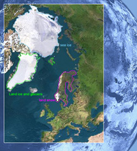
However, satellite images are considered to be particularly useful when measuring
remote areas, such as the Arctic, where field measurements can be difficult
to obtain.
Observed data relate to past and present conditions, and these data are used
as input for models, such as climate models.