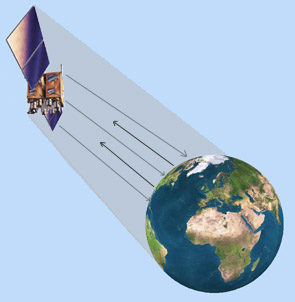

Satellite remote sensing is generally used to measure or obtain information
about relatively large areas such as large weather systems or county to continental-scale
images and maps. Aerial photography and other airborne sensors,
on the other hand, are generally used to map and measure relatively small
areas in greater detail.
A few of the environmental applications of data derived from remote sensing
include descriptions of current weather conditions, growth of urban or other
developed landscapes, the status of wetlands habitat, coastal erosion processes,
the location of oil spills, and the presence and extent of sea grass beds.
Remote sensing can be particularly valuable for assessing relatively large areas or observing inaccessible areas.