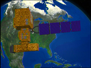
Some satellite programmes
| LANDSAT The Landsat Project is the longest-running enterprise for acquisition of moderate resolution imagery of the Earth from space. The Landsat 1 satellite was launched in July 1972; the most recent, Landsat 7, was launched in 1999. Over time, the sensors carried by the Landsat satellites have varied as technologies improved and certain types of data proved more useful than others. The Landsat images form a unique resource for applications in agriculture, geology, forestry, regional planning, education, mapping, and global change research. |
 |
SPOT
The first Systeme Pour l'observation de la Terre (SPOT) satellite,
developed by the French Centre National d'Etudes Spatiales (CNES),
was launched in early 1986, and the third was launched in 1993. The sensors
operate in two modes, multispectral and panchromatic. SPOT is commonly referred
to as a "pushbroom" scanner meaning that all scanning parts are
fixed and scanning is accomplished by the forward motion of the scanner. The
SPOT satellite can observe the same area on the globe once every 26 days.
The SPOT scanner normally produces nadir views, but it does have off-nadir
viewing capability. Off-nadir refers to any point that is not directly beneath
the detectors, but off to an angle. Using this off-nadir capability, one area
on the earth can be viewed as often as every 3 days. For
more on SPOT resolution and spectral bands, please see http://www.spotimage.fr/html/_167_224_555_233_.php